(PS - don't forget to enter the February giveaway)
Today, we're headed to the Pacific Northwest, where Alma (The Average Woman's Running Blog) will be our tour guide. Drop by her blog and say hi! In the meantime, here's where she would take us on a running tour of her hometown:

Coming to the Emerald City for business or pleasure? Looking for a local’s view of the city via sneaker? I’ve got three great, flat options for you, my friend:
- Downtown waterfront via Olympic Sculpture Park and Myrtle Edwards Park – Great for people staying downtown without a car.
- Lake Washington waterfront – Popular running route great for sunrise runs.
- West Seattle / Alki Beach – Stunning cityscape and Olympic Mountain views.
Honestly, running downtown sucks. It can be stinky and stressful unless you’re running early in the morning before traffic picks up. Plus, you are constantly stopping and starting at each block waiting for lights to turn (yes, we obey walk signs here). The good thing is that this is easy to escape. From where ever you are, just head west until you reach the waterfront (Alaskan Way). Cross over to the “water side,” start running north, then you will have miles of uninterrupted path to enjoy the sights, sounds, and smells of Elliot Bay and downtown Seattle.
Our entire waterfront is a tourist area with restaurants, charter boats, public ferries, Seattle Aquarium, parks, shipping boats, etc. You can check out all these sights as you run north along Alaskan Way. At the same time, you can see beyond the bay to Bainbridge Island and the Olympic Peninsula, with the snow-covered Olympic Mountains in the distance.
 |
| Olympic Mountains and Elliot Bay (view from Myrtle Edwards Park) |
On the way back into town, the view changes as you look to the south.
 |
| Seattle skyline and Elliot Bay |
 |
| Mount Rainier, Duwamish River, Port of Seattle |
Run this at the end of the day to enjoy the sunset. Bring some $ and stop in at Anthony’s Fish Cafe for a local microbrew to finish out the sunset then walk back to your hotel. If you’re a morning tourist, then run back via Pike Place market (take the Hillclimb across from the Aquarium to get there) and stop at Three Sisters Bakery for coffee and treats.
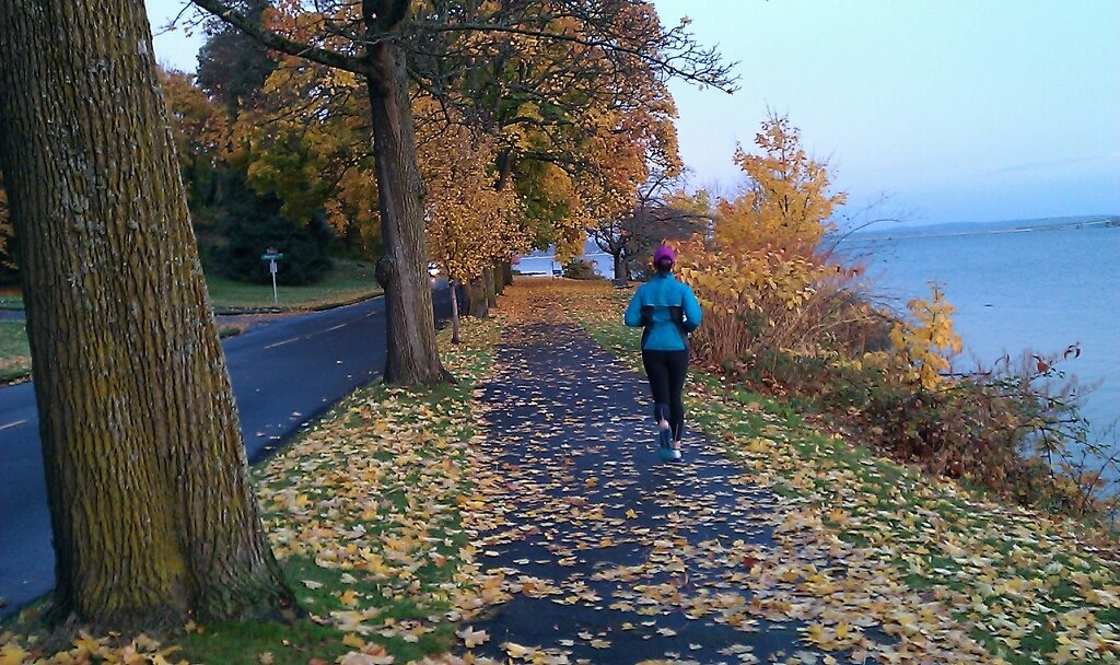
Lake Washington Waterfront
If you have access to a car and are running in the early morning, head over to Lake Washington to enjoy sunrise over the water and views of the Cascade Mountain range. If you’re visiting in summer, this is a great run to do the evenings as well. Pack a picnic dinner and go for a swim to cool off. I recommend starting at one of three public parks on the lake, each of which will provide water, toilets, swimming beaches, showers, and nearby coffee/beer stops: Madison Park, Leschi Marina, Seward Park.
If you start in Seattle’s upscale Madison Park, you will be near the Highway 520 floating bridge.
 |
| Madison Park, with view of Hwy 520 floating bridge and Cascade Mountains |
 |
| Lake Washington path |
 |
| Rowing on the lake, just north of Seward Park |
 |
| Trail along Lake Washington, < 1 mile north of Seward Park |
For a more unique view of Seattle, jump on the West Seattle Bridge and take the exit to SW Admiral Way, following the road north, up and around the peninsula. This is a great out & back course along the waterfront for varying mileage and wonderful views. I recommend starting near the Statue of Liberty / Bath House so you can have access to toilets and plenty of coffee shops and food/pubs for post-run refreshments. There are two great runs from this starting point: north around the peninsula to Lincoln Park (7 miles RT), or south along the water to the water taxi (4 miles RT).
If you pick the northern route, you’ll get views of Bainbridge and Vashon Islands, as well as the Olympic Peninsula. Head north from the Statue of Liberty along the water, and just follow the water the entire route. In < 0.5 mile, you’ll get into a residential area and the road will bend south. Enjoy the smell of salt water, fresh breezes, and views of the Vashon Island/Southworth ferry as you follow the waterfront.
 |
| View from Lincoln Park |
If you pick the southern route, you’ll have views of Elliot Bay, the Bainbridge Island and Bremerton ferries, and the Seattle skyline. Head south from the Statue of Liberty along the boardwalk and simply follow the boardwalk the entire way.
 |
| Alki Blvd Boardwalk |
 |
| View of Seattle skyline from Alki Beach |
Other resources
If those three routes don't keep you busy enough, or if you are looking for a social running event, check out Fleet Feet Running (Capital Hill), Sound Sports (downtown), or Super Jock & Jill for regular group runs and information about local clubs. The best resource for information on local races is at the Seattle Runs website.
If you are looking for more ideas, contact the Average Woman Runner and I’ll be happy to help you find additional routes.
Happy running!
Makes me want to go for a run!
ReplyDeleteGreat pics, Alma! I love Alma and I love Seattle.
ReplyDeleteCan I "like" that comment above? :)
ReplyDeleteSo fun! This is a great post. Alki is my home base, I do about 90% of my runs along Alki Trail. I also find it a safer (and still beautiful!) choice at night because it is very well lit along the route from the bathhouse up around the tip of the peninsula and Alki Trail is off of the street and there are usually still lots of other people out. It probably doesn't matter that much, but technically if you want to stay along the point towards the water taxi from the bathhouse, you head northeast and if you want to head towards Linoln Park you head southwest.
ReplyDelete